top

         
ICT HOME
SLAMnet HOME
    PORT OF FELIXSTOWE  


maps and facts

 
Return
 
    reference information on the Port of Felixstowe
 

cargo containers

container handling

vessel planning

the Vessel Planner Game

the computer system

careers at Felixstowe

home


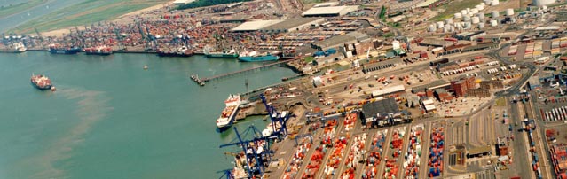
Click on the images below for detailed information about the Port of Felixstowe. The aerial photograph is particularly striking. For further information visit the port's website: www.portoffelixstowe.co.uk .


Maps

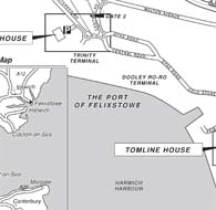
Maps of the area and the port (PDF file, 343 KB)

   
Aerial photograph

Aerial photograph (JPG file, 2.66 MB). Note that this is a large file.

   
Plan of the port

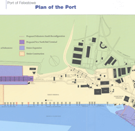
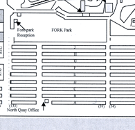
Plan of the port (PDF file, 364 KB).

   
Plan of containers matrix Plan showing the matrix system for locating containers - row letters and stack numbering (PDF file, 149 KB).
   
Key facts and figures Key statistics (PDF file, 197 KB).
   
Trinity information

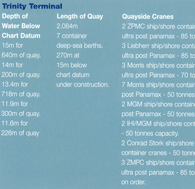
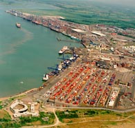
Information sheet on Trinity quay (PDF file, 383 KB).

   
Landguard information

Information sheet on Landguard quay (PDF file, 432 KB).


top of page
ICT HOME
SLAMnet HOME